 |
|

How to reach us
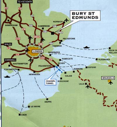
Road - From the Midlands or the East Coast, follow the A14.
Bus - There are bus stations in both Bury St Edmunds and Haverhill. The
former is serviced by National Express coach connections from all
over the country.
Train - Bury St Edmunds has its own railway station, connecting to
Cambridge, Ipswich and the London-Norwich line.
Sea - Passenger ferries from northern Europe arrive at Harwich to the
south east of St Edmundsbury, approximately one and a half hours
away by car.
Air - Stansted Airport (tel: +44 (0)1279 680500), one hour by car, is
situated on the M11 at Bishop's Stortford.
|
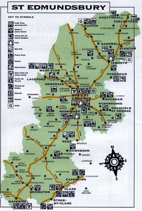
The Borough of St Edmundsbury lies in the west of the county of Suffolk, in the region of East Anglia. The Borough sits in the centre of the triangle created by the cities of Norwich, Ipswich and Cambridge. It runs from Haverhill in the south, near the Essex and Cambridgeshire borders, up to Knettishall and Euston on the Norfolk boundary. Set in the middle is Bury St Edmunds, the historic market town. It is an area of unspoilt natural beauty, largely excluded from the developments of the Industrial Revolution and with a keen sense of its rural heritage. As a unit of local government the St Edmundsbury Borough Council began life in 1974 and ended in 2019. On 1st April, 2019, the culmination of years of negotiations and close working between Forest Heath and St Edmundsbury councils came to fruition with the formal establishment of the West Suffolk Council.
The old area of St Edmundsbury
Useful Numbers and Addresses Bury St Edmunds Tourist information points can be found at a number of sites in the town centre. Tourist Information Points are closed Christmas Day, Boxing Day and New Year's Day.
Their services include:
Visitor Information Pack and Visitor Guide
Bury St Edmunds Record Office
Bury St Edmunds Bus and Coach Station
|
| Updated 1st July, 2019 | Go to Home Page |