 |
 |
|
|
How to download and collect map sets from Ordnance Survey Introduction Since 2010 the Ordnance Survey has made available free-to-use maps for business and private use known as OS OpenData. These maps come in a bewildering list of products which can appear formidable to the beginner. Much of this difficulty has been discussed under the webpage 'Resources- links...' above. One useful dataset for use at a regional level is called OS Strategi, and we shall attempt to download this as an example.
|
 |
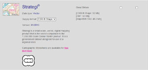
The link to Downloadable Ordnance Survey Products is shown under the Resources section above, but is repeated here:- Scroll down the list until you reach OS Strategi, and make sure that the drop down box called 'Supply format' contains 'ESRI Shape' which is the file format you want. Now click in the right hand empty box, which means you wish to down load it. (Click the left hand box if you want to wait for a DVD.) Scroll to the foot of the page and click 'next>>'. You now have a page of your name and address details to fill in, together with a security CAPTCHA box to fill in. Then click on 'continue>>. You will be sent an email with a link from which you make your download. Do it straight away as the link will expire in three days. You might like to create a new folder for the data before you download it. Then you can click 'Save as..' and browse to your new folder to receive the downloaded zipped file, called 'strtgi_essh_gb_zip'. Double click on the zipped file and then click'Extract all files'.
|
 |
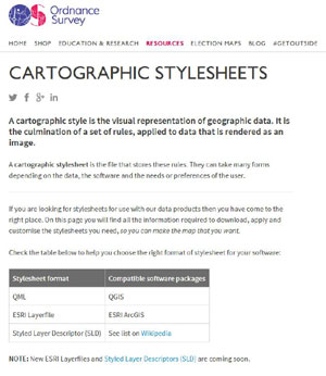
Now go back to the link shown above: OS OpenData downloads page Scroll down to the entry for Strategi once again and this time look for the "Cartographic Stylesheets are available for free download" entry and follow the link. Select the 'Download' option next to the Strategi entry in the list of available stylesheets. Try to save it with your Strategi data for reference. Also offered on this page is:
"Stylesheet User Guide If, by now, it feels like swimming in treacle, we have more to do yet!!
|
 |
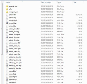
Now we have to do some file moving, using, not QGIS, but our usual operating system tools. In my case it is Windows Explorer. Hopefully you already know how to drag and drop files from one folder to another. Find your unzipped stylesheet file and open it. It should be a folder called 'Strategi-stylesheets-master'. Double click to open it and work your way through to 'ESRI Shapefile stylesheets' and open that by double clicking. Then double click on folder 'QGIS stylesheets (QML)'. Now you get a choice of 'Full Colour style' or 'Backdrop style'. I chose full colour. Now for ease of use, get all the .qml files sorted together. Do this by 'View/Sort by/Type'. Click on the topmost qml file, press and hold shift and click on the bottom most qml file. All qml files should be highlighted. Now open separately the 'strtgi_essh_gb' file, and double click your way through until you get to folder 'data' and open it. This is where you want your style files to reside. Go back to your highlighted qml files, and using a Right click, drag them into the 'data' folder. Release and select 'Copy here', and our styles should be in the right place. Your data folder should now look a bit like the picture adjacent, with qml files mixed with .shp , .prj etc files.
Now return to your QGIS stylesheets full colour folder, and locate the file called 'StrategiSymbols.ttf'. We have to copy this into our Windows font directory. So open 'Computer' click on the 'C' drive, open the folder called 'Windows', then open 'Fonts'. Now right click and drag 'StrategiSymbols.ttf' into 'Fonts'. (These are special symbols rather than a new font.)
|
 |
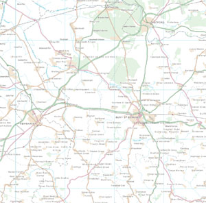
Open QGIS and click on 'Layer/Add layer/Vector Layer' and browse to your Strategi data file containing your shapefiles. Make sure the filter box at bottom right is changed to 'ESRI Shapefiles (*.shp*SHP)'. Now click on the shapefile at the top of the list, then press'Shift' and click on the bottom one in the list. This should highlight all the .shp files. Click 'Open', and 'Open' again. It may take a few seconds to load all this data but the whole country should appear. It looks a mess, but this map is designed for viewing from 1:75,000 to 1:175,000, so zoom in until it makes sense. Click on the adjacent thumbnail to see how the map might look at about 1:190,000, just outside the recommended limits. If you read the .PDF file entitled 'Quick start guide' in the Stylesheets folder you can find the recommended order that OS wants you to display the layers. You can move layers up and down within the 'Layers' pane on the QGIS main window, by drag and drop. The map should change accordingly. However, for our current purposes, you need not bother to do this at present, as we will only be using a couple of layers in our mapmaking examples below. We will be using 'coastline' and 'rivers_line'. Maybe later we will also use 'settlement_seed'.
All maps which contain any Ordnance Survey OpenData must feature the following acknowledgement:- ‘Contains Ordnance Survey data © Crown copyright and database right 2013’
The OS Strategi file is comparatively simple to use because the data covers the whole country in one file. Maps on a larger scale are supplied in "Tiles", which are sections of the country, perhaps 100 km wide per tile. This means that you have the added complication of downloading those tiles which cover your area, and then unpacking each folder so that you can easily load the tiles together.
|
| Go to DIY digital mapping Homepage |
This page created 6th October 2015 Last updated 10th October 2015. | Go to Main Home Page |